UN
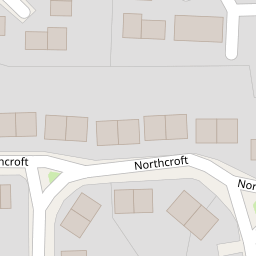
82 Northcroft
£ 144,000
Description
We don't have a Description for this property.
- Bedrooms
- 2
- Bathrooms
- 0

Leaflet © OpenStreetMap contributors
The heatmap indicates the level of crime in the area. The color of the heatmap indicates the crime severity and recency.
Metrics Year-on-Year
- Average area value
- 253,824.00 £Decreased by 7.21 %
- Average area rental value
- 927.00 £/moDecreased by 2.93 %
- Est rental Yield
- 4.38 %Increased by 4.53 %
- Crime Rate
- 16.00 %Unchanged by 0.00 %
from 273,543.00 £
from 955.00 £/mo
from 4.19 %
from 16.00 %
Nearby Schools
| Name | Type | Ofsted | Distance |
|---|---|---|---|
| Monksfield Way Children'S Centre | Children's Centre | 0.26 KM | |
| Claycots School | Community School | Good | 0.28 KM |
| Beechwood School | Academy Converter | Requires improvement | 0.49 KM |
| St Anthony'S Catholic Primary School | Academy Converter | Good | 0.58 KM |
| Arbour Vale School | Academy Special Sponsor Led | 0.60 KM |
Images
Nearby Streets
| Name | Average Price | Average Sqft | Distance |
|---|---|---|---|
| Aldridge Road | £ 400,000 | 0 | 0.00 KM |
| Hemming Way | £ 0 | 0 | 0.00 KM |
| Farnham Lane | £ 405,204 | 0 | 0.00 KM |
| Commonwealth Place | £ 0 | 0 | 0.00 KM |
| Rectory Close | £ 0 | 0 | 0.00 KM |
Nearby Transport
| Name | NLC | TLC | Distance |
|---|---|---|---|
| Burnham | 3176 | BNM | 2.83 KM |
| Slough | 3172 | SLO | 4.09 KM |
| Windsor And Eton Riverside | 5672 | WNR | 5.47 KM |
| Windsor And Eton Central | 3175 | WNC | 5.61 KM |
| Taplow | 3151 | TAP | 6.60 KM |
Nearby Listings
| Address | Price | Type | Score | Distance |
|---|---|---|---|---|
| Southcroft, Slough, SL2 | £ 575,000 | BUY | 7 / 10 | 0.07 KM |
| Slough, Berkshire, SL2 | £ 300,000 | BUY | Unknown | 0.09 KM |
| Northcroft, Slough, SL2 | £ 350,000 | BUY | 7 / 10 | 0.12 KM |
| Long Readings Lane, Slough, Berkshire, SL2 | £ 398,950 | BUY | 5 / 10 | 0.21 KM |
| Crofthill Road, Farnham Royal, Slough | £ 475,000 | BUY | 5 / 10 | 0.27 KM |
Nearby Properties
| Address | Price | Distance |
|---|---|---|
| 68 Northcroft | £ 160,000 | 0.00 KM |
| 59 Northcroft | £ 89,500 | 0.00 KM |
| 66 Northcroft | £ 175,000 | 0.00 KM |
| 55 Northcroft | £ 400 | 0.00 KM |
| 78 Northcroft | £ 205,000 | 0.00 KM |